Sorata
Sorata (Aymara: Surat'a) is a small town in the La Paz Department in the Bolivian Andes, northwest of the city of La Paz and east of Lake Titicaca. It is the seat of the Larecaja Province and the Sorata Municipality. At the time of census 2001 it had a population of 2,217. It is a somewhat popular weekend getaway and a relaxing base camp for a growing number of hikers. It includes several small hotels, including a converted Italian mansion.
In colonial days, Sorata provided a link to the Alto Beni goldfields and rubber plantations, and a gateway to the Amazon Basin. In August 1781 it was the site of an unorthodox siege by the nephew of Tupac Amaru, Andres, and his 16,000 soldiers. They constructed dikes above the town, and when these had been filled with runoff from the slopes of the nearby peak Illampu, they opened the floodgates and the town was washed away. The citizens of Sorata have, in recent history, violently opposed what they see as the rule of a too centralised government. For example, in the summer of 2005, the town was blockaded and inaccessible for several days in response to the government's plans to privatise Bolivia'a oil reserves. It is said that during world war 2, many immigrants from the war came to this city.
In colonial days, Sorata provided a link to the Alto Beni goldfields and rubber plantations, and a gateway to the Amazon Basin. In August 1781 it was the site of an unorthodox siege by the nephew of Tupac Amaru, Andres, and his 16,000 soldiers. They constructed dikes above the town, and when these had been filled with runoff from the slopes of the nearby peak Illampu, they opened the floodgates and the town was washed away. The citizens of Sorata have, in recent history, violently opposed what they see as the rule of a too centralised government. For example, in the summer of 2005, the town was blockaded and inaccessible for several days in response to the government's plans to privatise Bolivia'a oil reserves. It is said that during world war 2, many immigrants from the war came to this city.
Map - Sorata
Map
Country - Bolivia
 |
 |
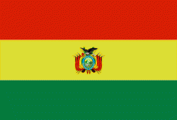
| Flag of Bolivia | |
The sovereign state of Bolivia is a constitutionally unitary state, divided into nine departments. Its geography varies from the peaks of the Andes in the West, to the Eastern Lowlands, situated within the Amazon basin. One-third of the country is within the Andean mountain range. With 1098581 km2 of area, Bolivia is the fifth largest country in South America, after Brazil, Argentina, Peru, and Colombia (and alongside Paraguay, one of the only two landlocked countries in the Americas), the 27th largest in the world, the largest landlocked country in the Southern Hemisphere, and the world's seventh largest landlocked country, after Kazakhstan, Mongolia, Chad, Niger, Mali, and Ethiopia.
Currency / Language
| ISO | Currency | Symbol | Significant figures |
|---|---|---|---|
| BOB | Boliviano | Bs | 2 |
| ISO | Language |
|---|---|
| AY | Aymara language |
| QU | Quechua language |
| ES | Spanish language |


